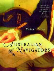
|
Australian navigators
: picking up shells and catching butterflies in an age of revolution
/ Robert Tiley. - East Roseville (N.S.W.) : Kangaroo press,
2002. - XI-243 p.-[8] p. de pl. : maps ;
24 cm.
ISBN 0-7318-1118-6
|
NOTE DE L'ÉDITEUR : In the mid-1700's Australia was a
largely forgotten curiosity at the bottom of the world. Still
only partly mapped by the dutch explorers who had made a series
of often disastrous visits in the previous century, it was regarded
as too distant, too hostile and too much trouble.
Then came the Australian Navigators.
Within a 40-year span, one of the bloodiest in European history,
legendary explorers including D'Entrecasteaux, Cook, Marion,
Bligh, Bass, Baudin and Flinders undertook the perilous journeys
of exploration to the southern continent. They were dangerous
enterprises, and of that illustrious company, only Bligh survived
long enough to retire. What motivated this great burst of interest?
Why did some succeed where others, particularly the French voyages,
failed ? Why were the French the first to publish a map
of Australia's coastline, some of it named after their Emperor
Napoleon ?
In this intriguing book, Robert
Tiley looks at the roots of the era in war-torn Europe and at
the complicated aims of the backers who supported and promoted
these expeditions. He shows how, in may cases, the Australian
Navigators were pawns in their floating political world, carrying
out missions whose underlying aims were often overtaken by political
events, or destroyed by their own weaknesses. He also explores
the thirst for scientific knowledge, and the effect that this
had on the navigators and their journeys.
A great deal has been written
on these explorers in weighty academic volumes. This book does
not seek to emulate them, but instead to capture the spirit of
the era and the personalitites and ambitions of the individuals
involved. They emerge fresh, convincing and compelling, as relevant
now as they were then. |
PATRICK-ANTOINE DECLOITRE :
Sydney-based author Robert Tiley is […] releasing a book, titled
Australian Navigators, which is devoted to the early European
explorers who discovered the Pacific ocean, including Australia,
[…]
The book purports to give a different
perspective to names often found in history books and Pacific
maps, such as Bougainville, Carteret, Wallis, Cook and Flinders.
Those, Tiley writes, have all contributed to a certain extent,
to the re-shaping of Europe's understanding of the Pacific region.
Cook was crucial in terms of setting up a school of navigators
that allowed the British to delineate coastlines and therefore
settle areas far quicker than any other nationality. However,
he couldn't have gotten there without the efforts of those before
him : Wallis, Byron, a very little known lieutenant called
Carteret, who discovered Pitcairn Island, says Tiley. And
the French, although somewhat behind the time vis a vis Cook,
couldn't have gotten to where they did without the efforts of
Bougainville and particularly Baudin.
Tiley regards Bougainville as
the most audacious of the navigators at that stage. He was
looking for new lands to settle. Obviously he realised what a
wonderful place Tahiti was, but he was chasing the great South
Land that all people believed existed somewhere south of Tahiti.
He was audacious because even though his men were starting
to suffer from scurvy and other problems and they were running
out of food and water, he was probably the first European to
approach the east coast of Australia before Cook.
Tiley also analyses the reason
why most European discovery missions were in fact looking for
a landmass in what was then a largely unknown region. It was
a fairly basic belief that in order for the earth to spin on
its axis, there needed to be a land mass down there to allow
it to spin without interrupting its orbit. Obviously the belief
assumed that the earth was a complete sphere, which it wasn't.
It took a while for people to realise that. So there was
an assumption that there had to be a landmass south of Tahiti.
It had been known for a long time that New Holland was not that
landmass, because Tasman in 1642 had sailed between the landmass
of New Holland and the west coast of New Zealand. It was assumed
that that west coast of New Zealand was in fact the west coast
of a larger continent or series of islands that linked up with
the southern end of America, Tiley explains. The early
navigators were seeking to find that continent for various reasons.
Ironically it was really the winds, more than anything else,
that tended to ensure that they could never even get to that
part of the globe to see if it was there.
☐ Oceania Flash (Revue de la presse d'Océanie), 31 juillet 2002
|
|
| mise-à-jour : 16 septembre 2005 |

| |
|